")
J-STORIES – The Tokyo metropolitan area aims to be disaster-resilient and to protect its citizens from natural disasters. With many rivers flowing through the area, authorities do their utmost to mitigate damage from flooding. The Metropolitan Outer Area Underground Discharge Channel is a unique feat of engineering built to keep homes and businesses safe and dry. Its dramatic pressure-adjusting water tank, known as the “underground shrine,” is also popular with both domestic and international visitors.
A One-of-a-kind Flood Control Facility Upstream from Tokyo
The Metropolitan Outer Area Underground Discharge Channel is one of the world’s largest pieces of flood control infrastructure. Its pressure-adjusting water tank, located in Kasukabe City, Saitama Prefecture, is open to visitors and is easily accessible by train from central Tokyo.
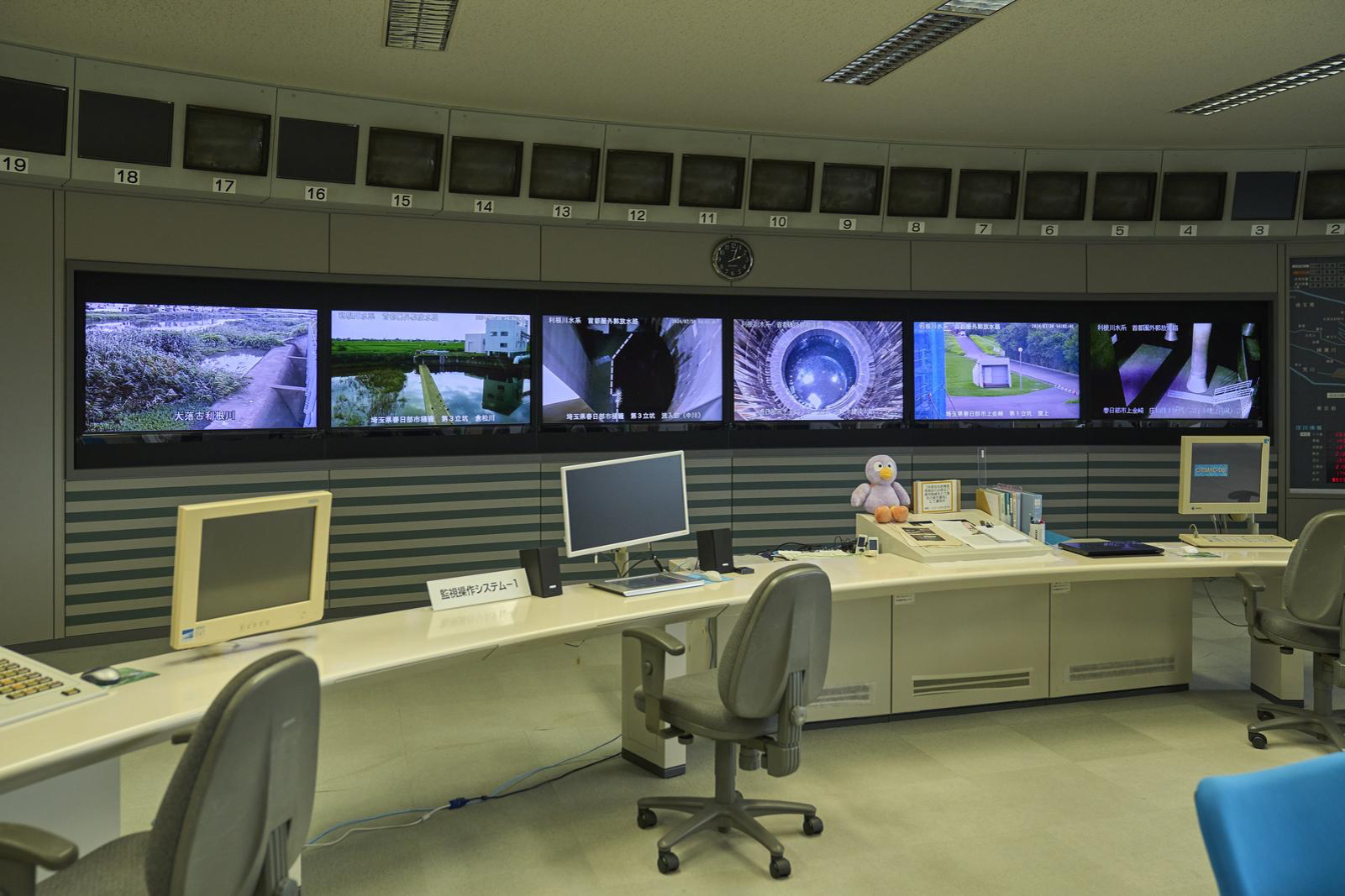
The channel is managed by the Ministry of Land, Infrastructure, Transport and Tourism’s (MLIT) Edogawa River Office, which oversees flood control infrastructure and related initiatives for the Nakagawa/Ayase River basin in the northern Tokyo metropolitan area. The metropolitan area encompasses Tokyo and parts of six neighboring prefectures.
The low-lying watershed is slow to drain and therefore prone to flooding during heavy rains, a phenomenon compounded by the area’s rapid development over the past 70 years, a change spurred by its easy access to central Tokyo. Although only 5% of the basin was considered “urban” — dominated by asphalt and buildings — in 1955, by 2015 urban land had expanded to 53%. As water-retaining rice paddies and fields were lost, the rivers became quicker to overflow.
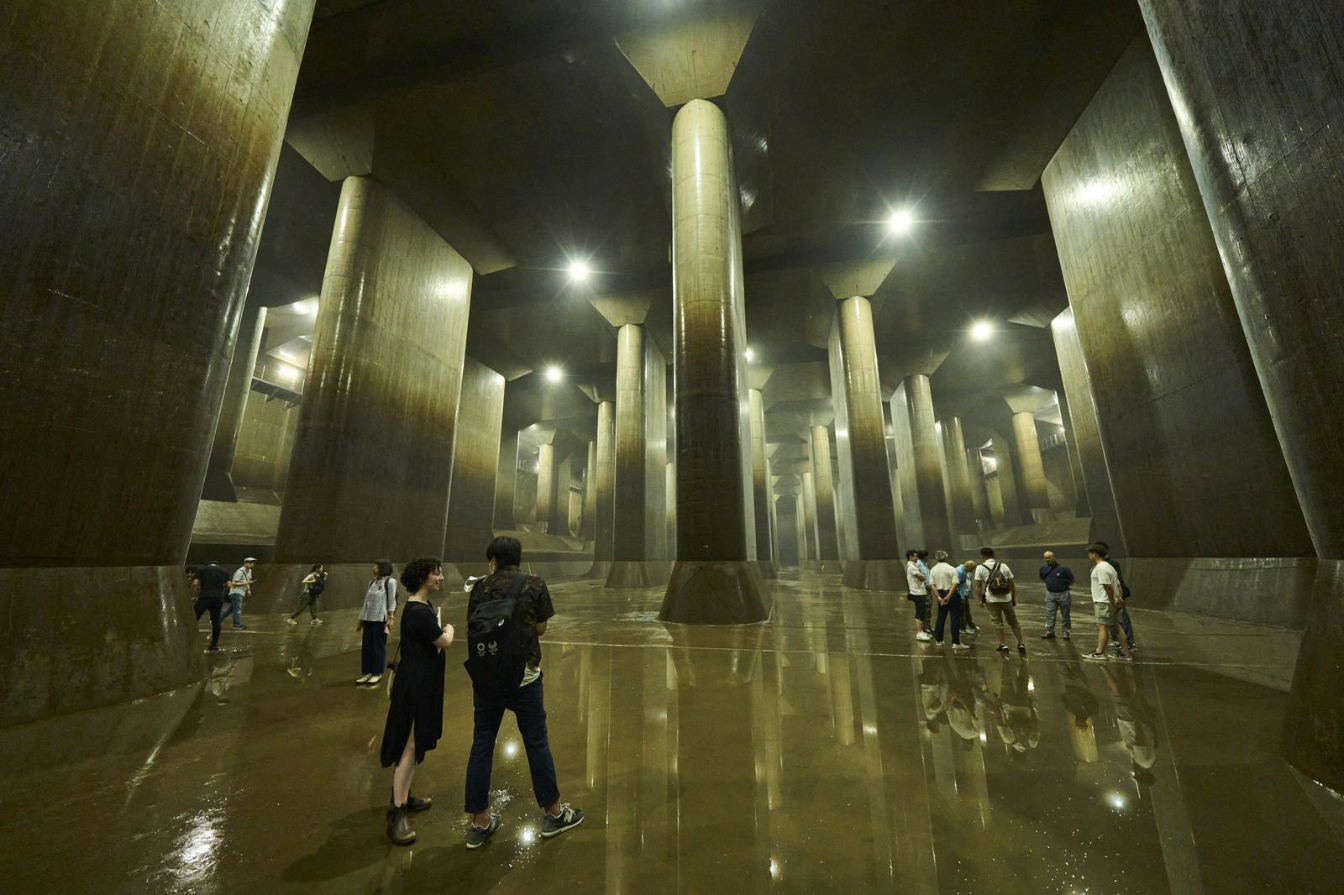
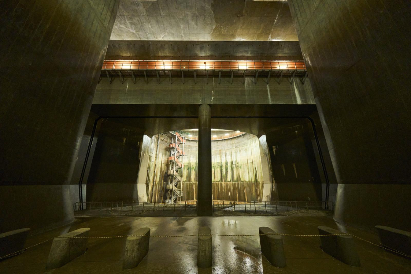
The underground discharge channel was built to address this issue. Completed in 2006 following 13 years of construction, the channel redirects overflow from the watershed’s small and mid-sized rivers. Put simply, water collected by overflow levees during heavy rains flows into underground shafts — each large enough to fit the Statue of Liberty — and is carried by tunnel to the pressure-adjusting water tank, a surprisingly photogenic space known as the “underground shrine.” The water is then pumped via turbine at a rate of 200 cubic meters per second to the Edogawa River, which flows into Tokyo Bay.
MLIT estimates that the channel, used an average of seven times per year, has reduced the economic effects of flood damage by approximately 148.4 billion yen during its first 18 years of operation. Located upstream of the metropolis, the channel functions as one of the main pillars of flood-resistant urban development measures that protect Tokyo from damage caused by heavy rains.
Descending to the Underground Shrine
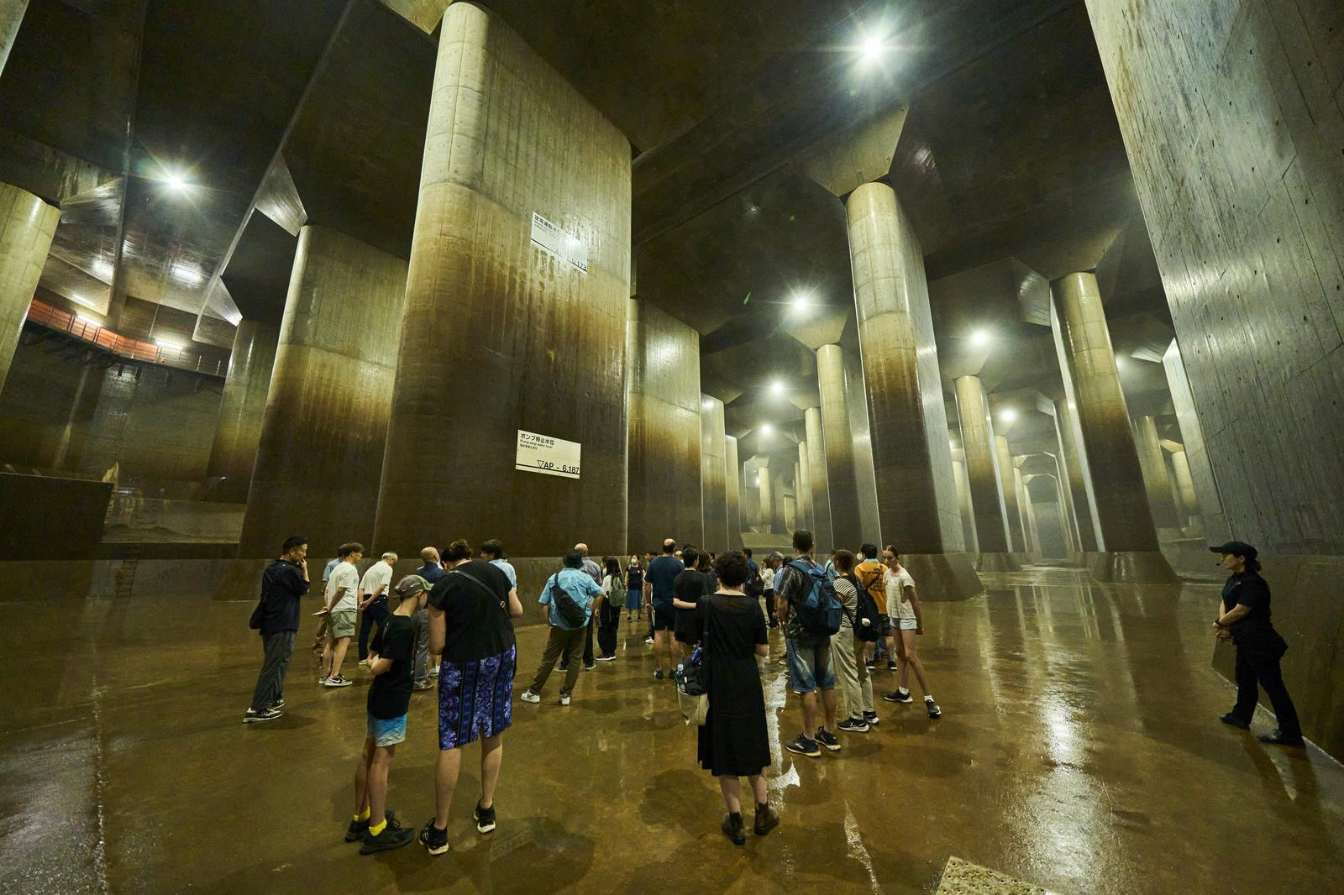
Four different tours of the discharge channel are available by reservation; we took the “Underground Shrine Course,” which lasts 55 minutes and costs 1,000 yen per person. The tour began with an explanation of the discharge channel in the RyuQkan exhibit hall lobby. Then, we descended on foot into the pressure-adjusting water tank.
A flight or two down the roughly seven flights of stairs, the temperature dropped perceptibly and the air became even moister than the humid summer outside. The descent was shorter than expected, which is good as there are no elevators or escalators.
Inside the water tank, rows of hulking pillars faded slightly into the gray mist toward the far side of the cavernous space. Nearer our tour group, sunlight filtered in through the round shaft from where, when the channel is in use, water flows into the tank. The floor was dotted with pools of water a centimeter or so deep, reflecting the lights and making water-resistant shoes a must. Occasionally, drops of condensation fell from the ceiling far above.
The huge, empty hall dressed in uniform concrete is striking, a vast feat of engineering at a scale necessary to tame rivers.
After further explanation by the guides about the size of the facility and the volume of water it can handle — only in Japanese, but with international guests following along via the multilingual audio guide app — we were given 20 minutes of free time to take photos and wander around a cordoned-off section of the vast hall.
The tour had a variety of participants, all making the most of the other-worldly scenery in their own way. A young couple dressed all in black took atmospheric photos, holding their phones at low angles to capture dramatic shots. Other visitors posed with a smile and peace sign, dwarfed by a massive pillar. A doting grandfather snapped shots of his lively grandkids.
Spreading Awareness of Disaster Prevention
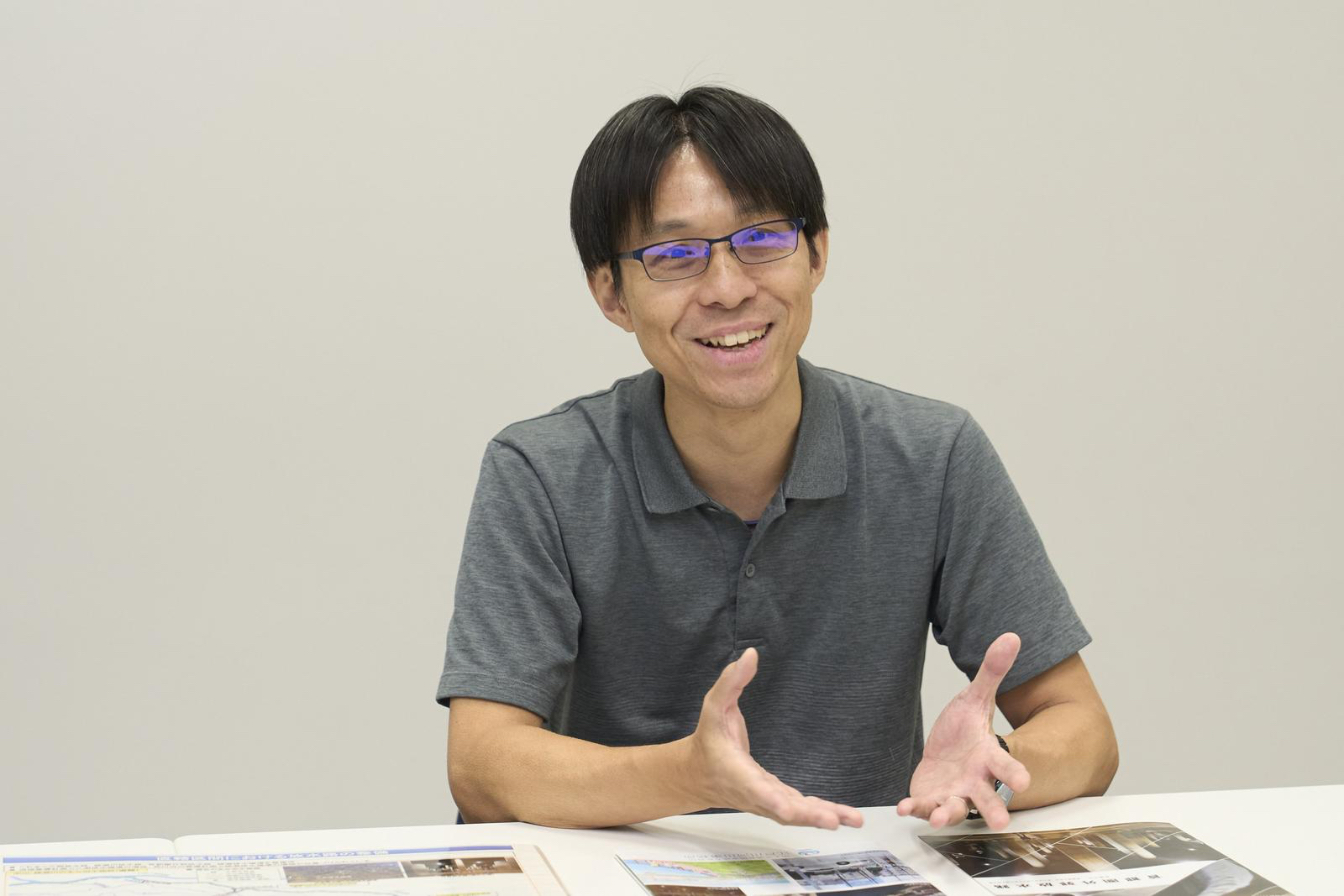
After the tour, we spoke with Sugama Daijiro, a specialist for construction work with MLIT’s Edogawa River Office, to learn more about the discharge channel.
“We believe it is important for people to understand this facility’s purpose, so we collaborated with contractors from the construction stage to be able to offer tours,” Sugama says. “It is also a government policy to promote flood control infrastructure as a tourism resource.”
Sugama estimates that roughly 10% of discharge channel visitors are international. The office also gives study tours for officials from other countries.
In addition to managing the discharge channel, the office works to prevent flooding in its jurisdiction through infrastructure projects such as levee improvements. It also implements various initiatives on disaster risk reduction, the local environment, and related education for children.
“Our office manages flood prevention across the watershed, not just in Tokyo or Saitama Prefecture,” Sugama explains. “We work to reduce pressure on the watershed as a whole through drainage.”
Despite the discharge channel’s efficacy and massive scale, Sugama cautions that it can’t mitigate flood risk completely. “We are always improving our infrastructure and thinking of flood countermeasures,” he says.
Sugama emphasizes that everyone in the community, not just the relevant authorities, can do their part: Households can install rainwater collection tanks and refrain, as much as possible, from draining baths during a flood alert. Residents should understand evacuation procedures, as well as research hazard maps when choosing a place to live, he adds.
Visiting the Underground Discharge Channel is not only a chance to marvel at the scale and possibilities of engineering, but also an opportunity to reflect on disaster preparedness and our place in the dynamic natural environment around us — even in the world’s largest metropolitan area.
To read the original article and more stories about what Tokyo offers, please visit Tokyo Updates’ website.
Interview and written by Annelise Giseburt
Photos by Fujishima Ryo
The Metropolitan Outer Area Underground Discharge Channel
Ministry of Land, Infrastructure, Transport and Tourism Edogawa River Office
https://www.ktr.mlit.go.jp/edogawa/index.html *Japanese language site