")
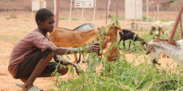
J-STORIES ー 宇宙衛星が観測した地球のデータを、農業生産や社会インフラの整備などに役立てる動きが広がっている。衛星から届く各種のデータを分析することで、これまで気づかれなかった土地の利用価値を世界規模で再評価できる。そうした分析情報を活用し、農産物の収穫改善、事業に最適な土地探しや災害が起きるリスクの判定など、様々な取り組みが始まっている。
宇宙からの衛星データが最も活用されている分野のひとつが農業関連だ。青森県の新しいブランド米として2015年から売り出された「青天の霹靂」は、同県の産業技術センターが農地の衛星画像データを使い、農家に最適な収穫時期を知らせるなどの生産指導を行っている。
「青天の霹靂」は販売開始以来、7年続いて全国の食味ランキング(日本穀物検定協会が実施)で最上位の特Aを取得。その評価が反響を呼び、今も他の地域からこの例に学ぼうとする動きがある。
宇宙からのビックデータは、事業目的に合った最適の土地を探し出すサービスなどにも使われている。2019年にJAXA(宇宙航空研究開発機構)職員らが設立したスタートアップ企業の天地人(東京都港区)は、JAXA、NASA(米航空宇宙局)、ESA(欧州宇宙機関)など国内外の地球観測衛星など多くのデータを活用し、独自の土地評価エンジン「天地人コンパス」を開発した。
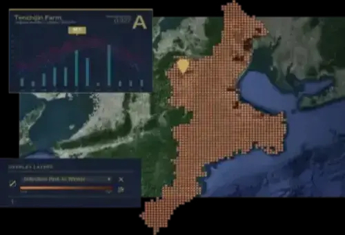
天地人コンパスは、衛星がとらえた地表面温度や降雨などの気象情報や地形情報などを、地上データなどと複合的に分析し、土地の利用価値について新たな評価を行うサービスだ。目的に応じた土地の抽出や土地が持つリスクの判断などができ、休耕地や耕作放棄地の再生にもつながるとの期待もある。
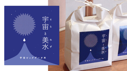
昨年からは、大手米卸会社、農業ベンチャーとの協業で「宇宙ビッグデータ米」を商品化。衛星データを使って土地を選定し、栽培、販売までを行うプロジェクトで、宇宙開発利用の推進に貢献したとして3月に政府から表彰を受けた。他にも、畜産乳牛の餌となる牧草の生育環境に適した土地探しや、キャンプ場候補地の選定なども行っている。
社会インフラへの応用については、愛知県豊田市の上下水道局などと連携し、漏水可能性を判定する実証実験と支援ツールの開発に着手。今年7月、衛星データ利用の拡大をめざす政府の実証事業として採択された。
海外では、食品包材などへの印刷事業を手掛けるシンメイ(東京都中央区)とともに、エクアドルでカカオの持続可能な流通にかかわる新しいプロジェクトも10月から始まっている。
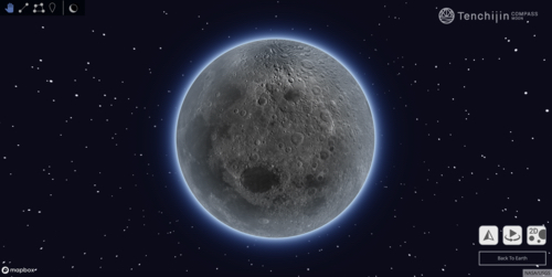
天地人コンパスは年々新しい機能を加え、今年7月には利用料金が要らないフリープランもリリース。さらに11月の皆既月食に際しては、誰もが無料で月の様子を楽しむことができる「天地人コンパス MOON」のサービスも開始。今後は月の3D地形情報の分析機能を強化し、月面開発に貢献できるサービスも目指しているという。
記事:嵯峨崎文香 編集:北松克朗
トップ写真:RLTheis/Envato
この記事に関するお問い合わせは、jstories@pacificbridge.jp にお寄せください。